Log in
All resources
Create a design
494 Free Artworks of Old Maps Of London
maps from the earth and its inhabitants, vol. iv
bibliothèque nationale de france
chorographia britanniae (1741-1742)
a school geography (1898) by bird
the comprehensive history of england (1876)
english-language maps showing history
1870s maps showing history
maps from the earth and its inhabitants, vol. xiii
19th-century maps of yorkshire
old maps of south africa
chorographia britanniae (1741-1742)
18th-century maps of staffordshire
chorographia britanniae (1741-1742)
18th-century maps of leicestershire
chorographia britanniae (1741-1742)
18th-century maps of devon
chorographia britanniae (1741-1742)
old county maps of county durham
chorographia britanniae (1741-1742)
18th-century maps of yorkshire
chorographia britanniae (1741-1742)
18th-century maps of lincolnshire
18th-century maps of buckinghamshire
chorographia britanniae (1741-1742)
18th-century maps of northamptonshire
chorographia britanniae (1741-1742)
chorographia britanniae (1741-1742)
18th-century maps of dorset
chorographia britanniae (1741-1742)
18th-century maps of somerset
chorographia britanniae (1741-1742)
18th-century maps of berkshire
18th-century maps of gloucestershire
chorographia britanniae (1741-1742)
chorographia britanniae (1741-1742)
18th-century maps of cheshire
chorographia britanniae (1741-1742)
18th-century maps of worcestershire
chorographia britanniae (1741-1742)
18th-century maps of warwickshire
chorographia britanniae (1741-1742)
18th-century maps of suffolk
chorographia britanniae (1741-1742)
18th-century maps of shropshire
18th-century maps of herefordshire
old county maps of herefordshire
18th-century maps of norfolk, england
chorographia britanniae (1741-1742)
chorographia britanniae (1741-1742)
18th-century maps of rutland
chorographia britanniae (1741-1742)
18th-century maps of bedfordshire
chorographia britanniae (1741-1742)
18th-century maps of derbyshire
a picturesque tour along the river ganges and jumna in india (1824)
s. j. neele & son
the comprehensive history of england (1876)
english-language maps showing history
chorographia britanniae (1741-1742)
18th-century maps of wiltshire
old maps of south africa
maps of the great trek
maps from the earth and its inhabitants, vol. iv
maps of loch fyne
maps from the earth and its inhabitants, vol. vii
maps of the yellow river
maps from the earth and its inhabitants, vol. iv
mouth of tay
maps from the earth and its inhabitants, vol. iv
maps of kirkwall
maps from the earth and its inhabitants, vol. xiii
ethnographic maps of africa
old maps of dublin
dublin bay
old hemisphere world maps (partner files)
arnold's geographical handbook (1899)
a school geography (1898) by bird
old maps of french polynesia
maps from the earth and its inhabitants, vol. xvii
anton francesco lucini
maps from the earth and its inhabitants, vol. iv
old maps of the lake district
old maps of la gomera
1878 maps of spain
maps from the earth and its inhabitants, vol. iv
old maps of the lake district
maps from the earth and its inhabitants, vol. xiii
maps of weather and climate of south africa
in the volcanic eifel. a holiday ramble (1896)
old maps of eifel
the cruise of the marchesa (1889)
kamchatka oblast
maps by thomas kitchin
old maps of scotland
a school geography (1898) by bird
old maps of athens
a school geography (1898) by bird
old maps of auckland
a school geography (1898) by bird
old maps of oresund
a school geography (1898) by bird
old maps of melbourne
a school geography (1898) by bird
old maps of sydney
maps by thomas starling
1842 maps
old maps of viceroyalty of the caucasus
19th-century maps of crimea
the cruise of the marchesa (1889)
old maps of kamchatka
maps from the earth and its inhabitants, vol. iv
bressay
maps from the earth and its inhabitants, vol. iv
loch etive
maps from the earth and its inhabitants, vol. iv
siornoway
maps from the earth and its inhabitants, vol. iii
old maps of halle (saale)
the comprehensive history of england (1876)
english-language maps showing history
the comprehensive history of england (1876)
english-language maps showing history
the comprehensive history of england (1876)
english-language maps showing history
westmorland, cumberland, durham, and northumberland (1858)
old maps of westmorland
the comprehensive history of england (1876)
english-language maps showing history
old hemisphere world maps (partner files)
arnold's geographical handbook (1899)
peru. incidents of travel and exploration in the land of the incas
yucay
maps from the earth and its inhabitants, vol. iv
old maps of hastings, england
maps from the earth and its inhabitants, vol. iv
old maps of windsor
maps from the earth and its inhabitants, vol. iv
old maps of the isle of arran
maps from the earth and its inhabitants, vol. viii
maps of the mekong
maps from the earth and its inhabitants, vol. iv
old maps of dover, kent
maps from the earth and its inhabitants, vol. xviii
1870s maps of peru
maps from the earth and its inhabitants, vol. iv
old maps of leeds
maps from the earth and its inhabitants, vol. iv
old maps of sheffield
maps from the earth and its inhabitants, vol. iv
old maps of leeds
maps from the earth and its inhabitants, vol. xiv
old maps of sydney
arnold's geographical handbook (1899)
old maps of lanarkshire
maps from the earth and its inhabitants, vol. xiv
old maps of sydney
maps from the earth and its inhabitants, vol. iv
bathymetric maps of the irish sea
maps from the earth and its inhabitants, vol. viii
maps of the mekong
maps from the earth and its inhabitants, vol. iv
old maps of exeter
maps from the earth and its inhabitants, vol. iv
1870s maps of scotland
maps from the earth and its inhabitants, vol. iv
old maps of swansea
maps from the earth and its inhabitants, vol. iv
1870s maps of scotland
maps from the earth and its inhabitants, vol. xviii
1870s maps of peru
maps from the earth and its inhabitants, vol. x
19th-century maps of the nile delta
maps from the earth and its inhabitants, vol. x
19th-century maps of the nile delta
maps from the earth and its inhabitants, vol. iv
old maps of sunderland
maps from the earth and its inhabitants, vol. iv
1870s maps of wales
a school geography (1898) by bird
old maps of hong kong
maps from the earth and its inhabitants, vol. iv
old maps of newcastle upon tyne
old maps of the sinai peninsula
1840s maps of arabia
chorographia britanniae (1741-1742)
18th-century maps of lancashire
maps by bernard ratzer
maps by thomas kitchin
in the volcanic eifel. a holiday ramble (1896)
old maps of eifel
in the volcanic eifel. a holiday ramble (1896)
old maps of eifel
maps from the earth and its inhabitants, vol. iv
19th-century maps of kent
maps from the earth and its inhabitants, vol. iv
old maps of the isle of arran
maps from the earth and its inhabitants, vol. iv
old maps of lindisfarne
maps from the earth and its inhabitants, vol. iv
old maps of hastings, england
maps from the earth and its inhabitants, vol. iv
old maps of leeds
maps from the earth and its inhabitants, vol. iv
old maps of newcastle upon tyne
maps from the earth and its inhabitants, vol. xiii
old maps of luanda
maps from the earth and its inhabitants, vol. xvii
old maps of washington, d.c.
maps from the earth and its inhabitants, vol. iv
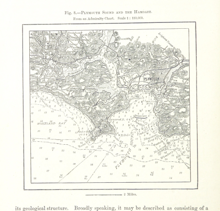
charts of plymouth sound
201 - 300 of 494
Next page
/ 5